Featured

Whitaker Point & Hawksbill Crag

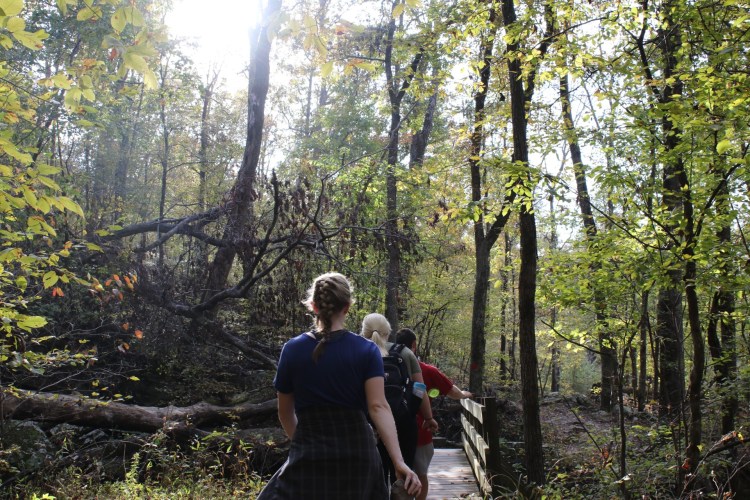
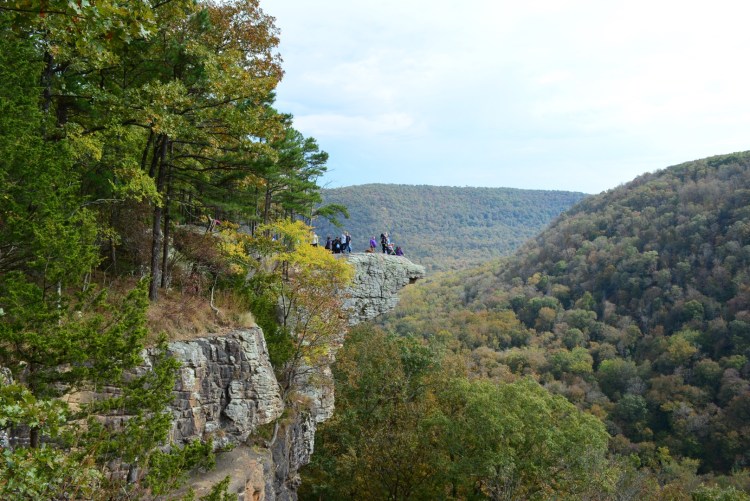
As one of the most iconic places in Arkansas, I wanted to write my first blog about Whitaker Point Trail. I hiked this trail in October when this picture was taken and the leaves were just beginning to turn. Then I hiked it again over winter break in December. It has gorgeous lookouts, a double waterfall, and the crag.

It is up a very steep, dirt road to the trailhead. I would be cautious about driving a low car up the mountain, although it appears to be graded for pot holes fairly often. I traveled in a truck and didn’t have any problems. I did noticed that there were a few cars parked by the trailhead, but most vehicles were SUVs or trucks. On the weekend in October the parking space was packed and it was hard to find a spot, but in December on a weekday it wasn’t as busy.

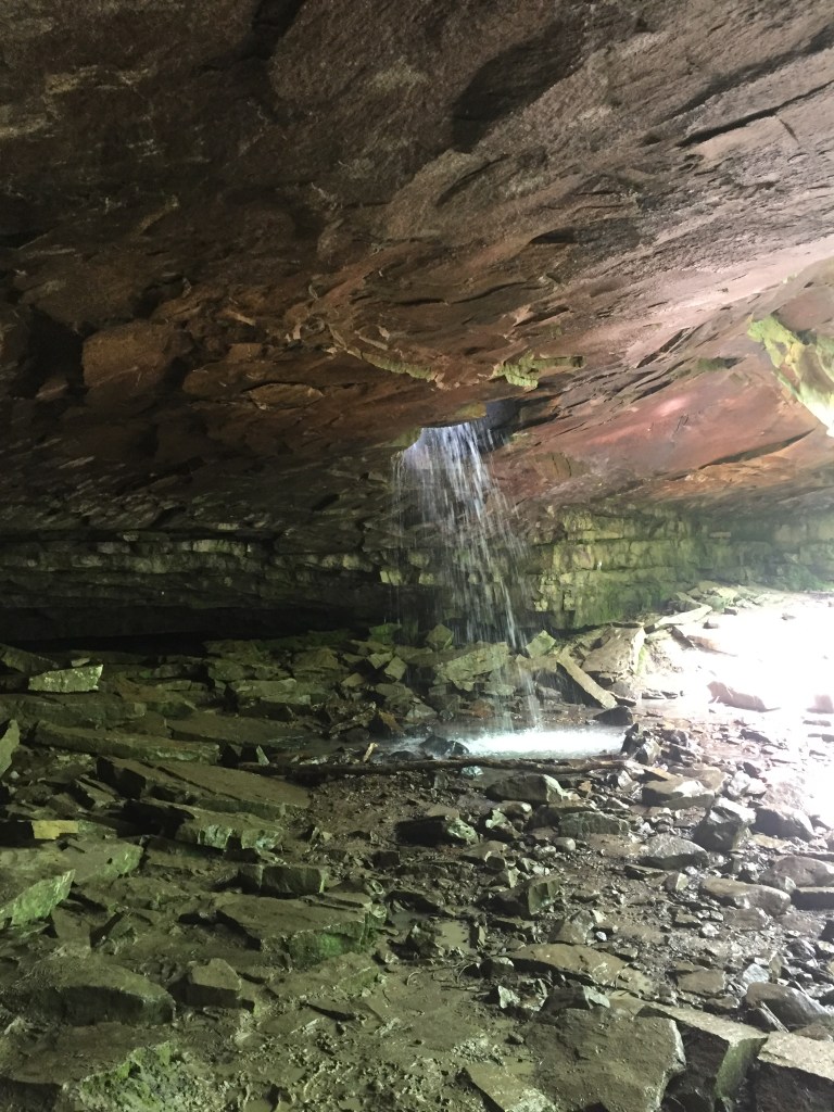
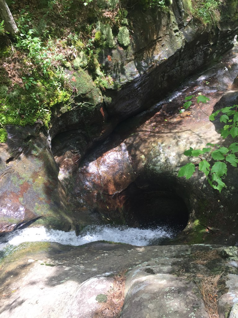
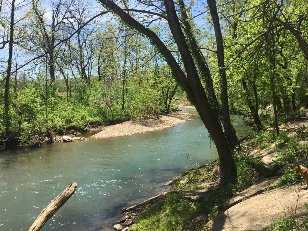
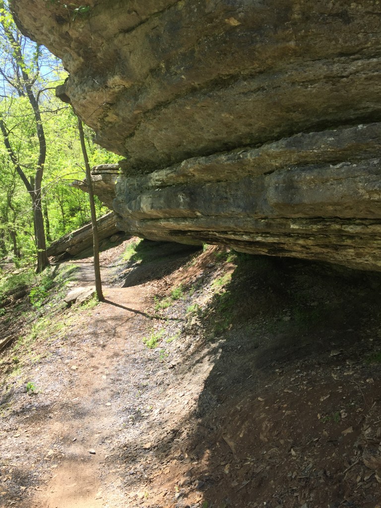
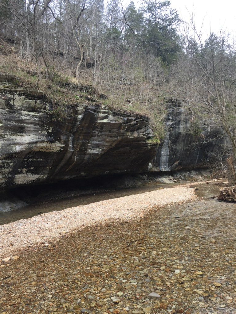
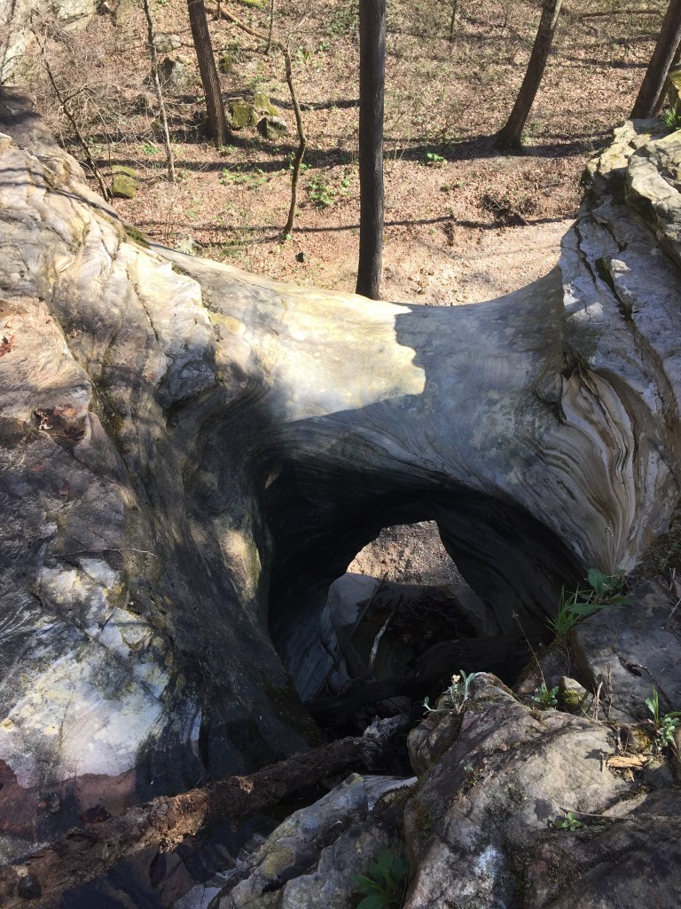
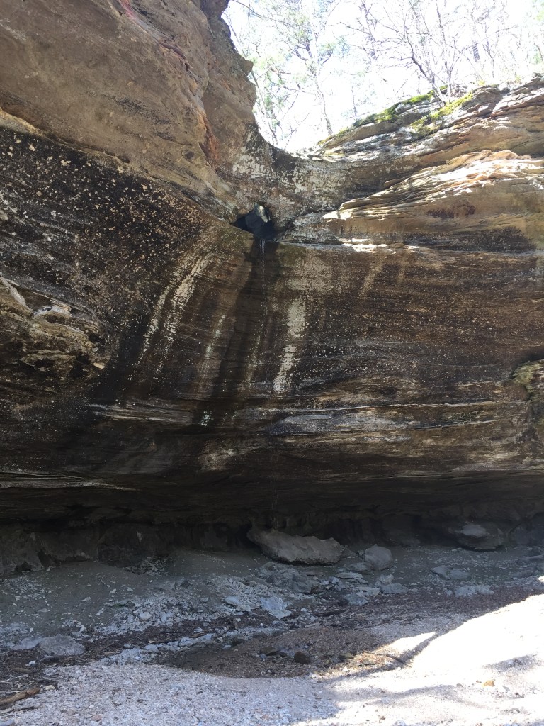
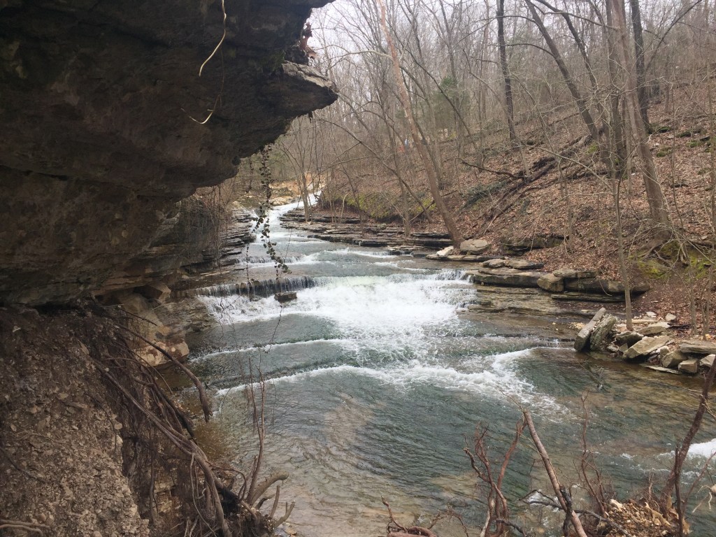
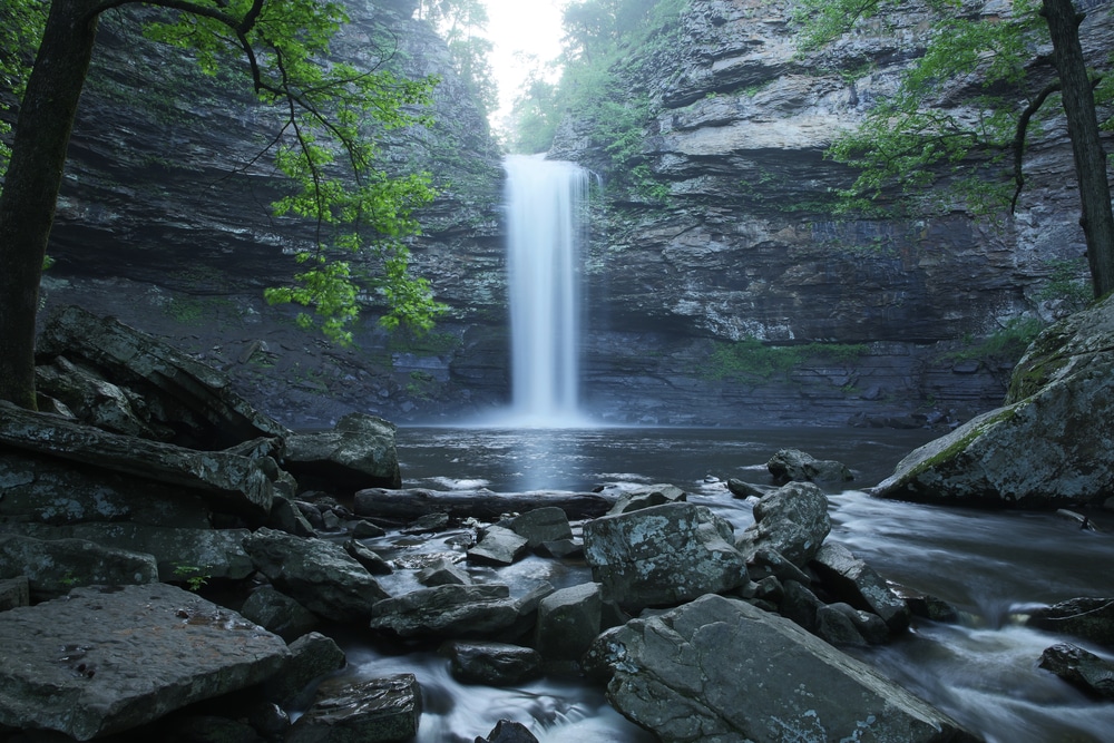
The trail itself is an out and back with a length of 2.9 miles. There is a creek about half way down that turns into a small waterfall. If you go off trail and explore the waterfall, there is a large cave in the side of the cliff behind it, and there is a second waterfall below it. Back on the trail there are cool rocks along the edge of the cliff between the crag and the waterfall.

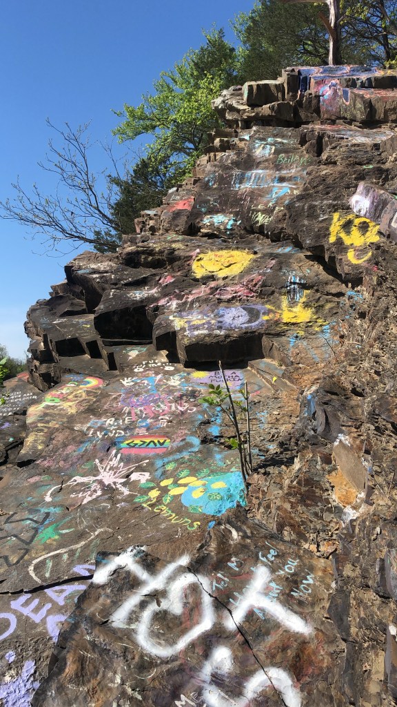
Just before the crag there are two places for great overlook views and pictures. The crag itself is fairly flat except for the point which isn’t as level. I recommend extreme caution and not getting close to the edge. There is the risk of severe injury with falling.

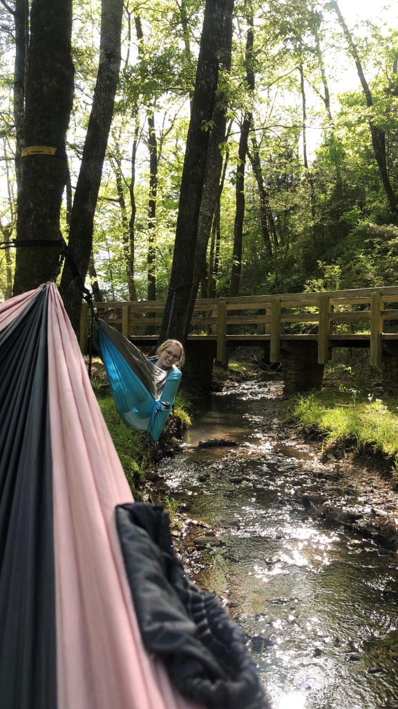
Because this is one of the most recognizable places in Arkansas, it is heavily trafficked. The trail is well worn and easily followed. It is also dog friendly and many furry friends visit the trail on leashes. Depending on the experience you want, try to plan your trip on a day of the week with human traffic in mind.

This is a view from on top of the crag in December.

Glory Hole

The Glory Hole trail is one of Arkansas’s most popular hikes. It is a 1.8 mile all downhill out and back type trail. The trailhead is right off the highway which is nice for any car type, however because the trail is so popular it may be hard to find a parking spot.

I went on this trail two days after it rained to make sure there would be water in the waterfall. It’s very important to plan Arkansas Waterfall Hikes in the spring or early summer and around the weather because many of the falls become dry.

I also want to strongly encourage proper hiking shoes. The decline hike as well as the reverse incline hike is on rocky and partly muddy areas. I saw quite a few people in sandals. If you are planning to get in the creek at the bottom of the trail, I recommend bringing two pairs of shoes.

The trail itself was very pleasant. It was fairly wide and well marked. Towards the bottom there are a few offshoots to walk around the water. The trail takes you to the top of the waterfall. You can see through the hole that the water has formed. There is a smaller trail to the right which will take you to the bottom of the waterfall. The creek continues down which can be fun to explore.

My parents and I were in a hurry to get back before a thunderstorm rolled in, so we did not spend much time exploring. We were able to make it down the trail in 20 minutes and back up in 20 minutes. You can spend as much or as little time on this trail because there is plenty to see, but we didn’t have time. I will be back here though!

Tunnel Vision Trail

This last trail was super disappointing. Based off of someone’s recommendation my parents and I hiked this 5.1 mile loop last weekend. It is located in Bella Vista, Arkansas. We parked at the Kingswood golf course parking lot. The trail entrance was on the immediate right. We walked down the trail which took us along the creek neighboring the greenway. The creek was crystal clear and moving swiftly.

Along the trail were cool rock formations and springs. The rocks sometimes formed cave-like hollows or they looked like a steep drop off from the area above. The springs came out of the rocks and fed into the creek. A few times I saw moss growing up the rocks in column shapes.

Due to the warmer weather, I have been more cautious in looking for snakes. I haven’t seen any yet, but they are moving now. I don’t take as many risks climbing through an off-trail area when I can’t see where my hands or feet are touching.

After just a short distance the trail leaves the creek and crosses a road. This is where you should turn around! The best part of the trail is over. The next two miles are completely up hill. We came across a couple of groups of bikers, but they were all going down hill. Once we were about half way done with the trail we saw the tunnel. I expected a natural tunnel, so I was disappointed with the culvert.

Based on a biker’s recommendation we went right at the tunnel on to Tweety Bird trail so that it would be a shortcut back to the car. This was a new trail and not on the hiking app that I use. I found that it actually was taking us farther away, so we bushwhacked off the trail and on to the street. By using our phone’s GPS we were able to follow the streets back to our car.

This was one of the harder hikes that I have done. The hills made the miles even more difficult. By the time we made it back to the car we had walked 5.6 miles. I wouldn’t recommend this trail unless you are more in shape and looking for a harder hike or if you are a biker.

North Forest Trail – Crystal Bridges

My latest outdoor retreat was to Crystal Bridges in Bentonville, Arkansas. The art exhibit is currently closed, but the trails surrounding the facility are open and beautiful. My parents and I parked at the top parking area and walked down towards the front entrance. We have walked the back Tulip Tree and Art Trails so we decided to try the North Forest Trail. Over the winter this area was closed for the North Forest Lights exhibit which was well reviewed however we didn’t see it.

This is my mom looking at the canoes.

The trail was well cared for and cultivated. Much of the landscape was covered in blooming flowers and trees. As you walked around the 1.6 mile trail, you could see some of the lights still in the woods from the winter exhibit. One of my favorite parts of walking around Crystal Bridges is coming across sculptures tucked away on the trail. Some of the art looks natural and it’s made of wood or stone. Other pieces are made of glass and metal. As I looked at one delicate glass sphere I wondered how it holds up under Arkansas weather conditions. My favorite sculpture on the trail was the huge thing of canoes tied together. It is called the Monochrome II, and it is supposed to “create the illusion that the canoes are frozen in time and space” according to Crystal Bridges website.

The trail was lightly trafficked. We only saw a couple of runners, one young family of bikers, and a few people reading on the benches. I thought that it would be a nice little get-away spot to read a good book.

After walking around the loop, we walked down to the North Lawn to look at the Fly’s Eye Dome which is quite unique. Overall it was another very pleasant experience at Crystal Bridges.

Hobbs State Park – Conservation Area

My mom and I went to a few short hikes in Hobbs State Park last week. We were trying to get out of the house on a nice day, and we were scoping out possible hikes for my grandparents to do the next time they visit. We did four short loops and it ended up being a fun way to spend the afternoon.

Shaddox Hollow

Our first trail was 1.4 miles. It was basically a circle that walks along the top of a hill and then it goes down into the valley. The trail goes next to Beaver Lake and has a few offshoots that let you explore that area. Walking back up the trail, we saw two caves and beautiful blooming dogwood trees. A creek also runs next to the trail and the running water was very peaceful. It was definitely an incline to get back to our car, but I enjoyed this hike.

Sinking Streams Trail

Right down the road on the main highway was Sinking Streams Trail. It had a pathed parking lot and picnic area. I had seen multiple cars there each time I drove past the trailhead. This 0.5 mile walk was a simple loop around a small stream. A family with two small children were also out enjoying this trail. It was flat and short, so I would take my grandparents on this one. There are two wooden bridges on the trail that my mom and I stopped to watch the water for a while.

Historic Van Winkle Trail

At the trailhead of Sinking Streams you can turn right and walk under the road to reach this trail. It is a 0.8 mile loop and my mom’s favorite from the day. The trail follows an area where an old lumber mill used to be. You can read about the mill on plaques along the way. The middle area of the trail is grazzy and open. It would be the perfect place for a picnic and then throw a frisbee or ball around.

Ozark Plateau Trail

This trail is located right beside the Hobbs Conservation building. It is a pathed and wheelchair friendly walking area. It is 0.6 miles long with benches and picnic tables. You can sit on the benches and look at the surrounding hillsides where other hikers or bikers are using trails. This is also a family friendly trail to use.

Tea Kettle Falls Trail

During this time of social distancing, a great way to mentally cope with these changes has been to take hikes outside. I am always happier after taking a break from screens and listening to the sounds of nature. I have been going to more secluded trails that are not as popular to avoid overcrowding and taking extra precautions to keep my distance.

Tea Kettle Falls is another trail close to Huntsville, AR. It is located at the bottom of a very steep gravel road. I would not recommend driving here unless you have 4-wheel drive because it took us a few tries to make it back up the hill. The trail is 2.2 miles and flat as it follows along a creek. In early spring, the red buds and violets along with the crystal clear water made the hike very beautiful.

At the end of the trail you have to cross the creek to get to the waterfall. Someone had placed a limb down to cross the creek because it is too wide to jump. The waterfall itself was not flowing very well even though it rained two days ago. Based on the natural debre line, I could tell that the waterfall had recently been flowing much faster.

It is named Tea Kettle after the unique formation. The water made two holes in the bluff: one in the top and in the side. When the water is flowing, it looks like it’s coming out of a kettle. You can climb to the top of the 46 ft waterfall by going up a crack in the bluff that’s closer to the creek. At the top of the waterfall you can see where the water has cut a crevice into the rock.

I read that this was one of the most impressive waterfalls in Arkansas (which is saying a lot), but I was disappointed. The waterwall would probably be more beautiful with higher water levels, but the trail itself is nice and still worth taking. I would suggest checking this trail out after it rains.

King’s River Overlook Trail

This trail is located near Huntsville, Arkansas. It is 1.2 miles and moderately hiked. I found this trial by seeing a friend post a picture of it on her Instagram. There is a dirt road to get to the trailhead and I would recommend having a vehicle that is not close to the ground to avoid scraping. It took about 25 minutes driving down the dirt road to get to the trail head. There was a gravel parking lot at the bottom of the hill.

The trail was clearly marked and fairly flat. The overlook is at the end of the trail, but we were actually there for a waterfall located off the path. After finding directions online (linked here) we ventured off trail. The directions were very helpful and we were also able to see a faint path where other people went to see the falls.

Eagle’s Nest Falls was truly breathtaking. You first come up to the top of the waterfall and see how deep the valley is. After climbing down into the valley, you enter the beautiful oasis. I loved seeing this waterfall because it was so secluded. I didn’t have to fight other people to simply look at it because no one else was around.

Viewing the waterfall from the right side, you can see a large stone that had fallen some time ago and separated the fall into two parts. The falls are probably between thirty to forty feet tall. The bluff was also carved out by the water long ago to form a cave or overhead shelter area.

After some time I left the waterfall to climb back out and get back on the trail. The walk was short to the overlook, but the view was pretty. It would probably be a breathtaking view during the fall when the leaves change. The river seemed to be flowing and was very blue. On the way back to the truck, I noticed that the trail was surrounded by dogwood trees but sadly they were not in bloom.

If you go to this trail make sure you don’t miss Eagle’s Nest Falls. It’s by far the best part!

Tanyard Creek

The Tanyard Creek Loop is 2.2 miles and located in Bella Vista. The first part of the trail is pathed. You can quickly exit the pathed trail onto smaller offshoots. I followed an offshoot that went along the creek. It was well maintained and gravel. The creek was flowing due to recent rain.

Along the trail are numerous signs explaining the types of trees and foliage. There were also plackes dedicating benches or areas in honor or memory of individuals. Next to many of the walking trails were bike trails. I saw quite a few bikers taking advantage of them.

The main attraction on the trail is the waterfall. It is man made, but very beautiful. A small lake was dammed and the waterfall is the result of overflow. If you walk across the bridge and see the full waterfall, I believe it is more impressive. Most of the other hikers seemed to only go to the top of the waterfall which is accessed on the other side of the water. After I saw the full picture, I doubled back and went to the other side so that I could get a closer look.

It was a very peaceful day. I could have sat near the waterfall for the entire afternoon. I saw a few families with small children making this hike. It was very easy and you are able to do as much or as little as you want. There were also a few dogs on a leash out enjoying the day.

Keep in mind that social distancing is very important right now. Safe home if possible and stay safe! This hike was done before we were told to avoid leaving home.

Petit Jean – Cedar Falls Trail

Petit Jean is a must see for the Central Arkansas area. The iconic Cedar Falls waterfall easily recognizable on so many Arkansas marketing photos. The trail is moderate and is a distance of 2 miles. Hiking time is about an hour and a half to two hours long although that can vary. It is heavily trafficked so go early in the morning if you want to avoid crowds.

The trail begins by Mather Lodge with a beautiful view of the valley. The first part of the trail, and the end because it is an out and back, is very steep. It has a lot of rocks and roots, so you have to be careful going down. Once you get to the bottom the trail is flat and easy to hike.

Along the way, there are fun places to stop and explore like a fallen tree. However the waterfall at the end is the main attraction. According to Arkansas State Parks, Cedar Falls is 95 feet and one of the tallest continually flowing waterfalls in the state. When there has been recent rain, the waterfall is really flowing and the creek fills up. The water has also been slow a few times I have gone so plan your trip carefully. Once, there was ice formed on the rocks close to the waterfall where it sprayed. It was really pretty.

The trail is dog friendly if they are on a leash. Again this is a very popular trail so plan your hike accordingly if you want fewer people on the trail.

The park is named after a French girl who legend has it “disguised herself as a cabin boy so she could secretly accompany her fiancé to the ‘New World.’ Petit Jean became fatally ill and requested to be buried here” (Arkansas State Parks).

Cauldron Settlement Park (Hippie Rock)

Although this is not one specific trail, I enjoy going to Cauldron Settlement Park as a quick get away from Conway. On my first time to visit, my roommate and I were looking for hippie rock and we just started down the Cauldron MTB Trail. This gave us beautiful views of the Arkansas River. We brought our hammocks and set up on a ledge for a while. Then we were under attack by two wasps and quickly ran away.

There were a couple of people and mountain bikers on the trail. You just have to be aware of others potentially coming up fast over hills or around curves. We hiked through the woods and eventually came across hippie rock. It was difficult to follow the trail because it had so many options and wasn’t clearly marked. I ended up just walking in the direction I believe it was in.

Hippie Rock is a popular hangout spot with many college students and young adults. I have only been there with just my party once. Every other time people join you on the rock or they are there first. The spray painted rocks can sometimes be slippery so be careful. It is also nice to climb down to the river side and enjoy your day there. Any spot that you find in this park is nice to just sit down and forget about work. There isn’t much walking or features to find here other than a view of the river.

Pro tip: You can drive your car up to the pavilion and walk just a few feet down to Hippie Rock

Devil’s Den Trail

Devil’s Den Trail is the place that I’ve hiked more than any where else. When I was a kid, my family walked this trail while we were in Fayetteville for my oldest brother to tour the University of Arkansas. Now my family lives in NWA and when friends come visit, we take them here.

It is a very easy 1.3 mile loop jam packed with features! The first thing you see are cool bolders that are fun to climb. Then you walk up a slight incline. At the top of this incline you come across large cracks in the ground. You can carefully climb down these cracks and walk to the other side of them or just continue on the trail to the other side.

This is one of the cracks. Not a cave.

This trail has a few cave entrances, but they are closed. The bats in North America are being killed by White Nose Sydrome which is spread by people carring the fungus from contaminated caves into new ones. This is why there are so many caves closed now in parks.

If you stand in one of the cracks, it is noticably much cooler air coming up. This place is called Devil’s Icebox. During the hot summer, Devil’s Icebox is a popular spot to stop and rest.

At one point on the loop, I found a waterfall just off the trail and over a hill. It isn’t possible to describe the location, but I found it by listening for running water. I climbed up the waterfall, but there wasn’t a second one. The stream got smaller.

The main waterfall in on the trail. It is typically running and there is a nice bridge that goes infront of it. This is a fun place for pictures! After the bridge, you hike down the slope and back towards the river.

Keep on the look out for rocks stacked on the river bed! It is to the right of the trail. You can NOT skip this! Make a rock stack and add to the collection. After this the trail is pretty much over, but there are some pretty bluffs to look at to the left. You were just on top of those bluffs when you looked at the cracks and caves.

Design a site like this with WordPress.com
Get started